FarmAId
An intelligent agricultural planning platform that utilizes soil analysis and advanced forecasting algorithms based on satellite data to recommend the most suitable crops for cultivation.
- 5,308 Raised
- 494 Views
- 1 Judges
Team
Tags
Categories
Gallery
Description
Problem
Farmers around the world face significant challenges. Unpredictable weather, degrading soil, and lack of access to modern farming techniques make it hard for them to make the right decisions. Many times, they end up with crop choices that don't suit their land or the climate, leading to poor harvests and financial losses. Climate change only worsens these problems, making traditional farming methods less effective. Additionally, in remote areas, farmers lack essential guidance and market information, leaving them at a disadvantage. All these issues not only impact the farmers' income but also threaten our food supply.
Solution
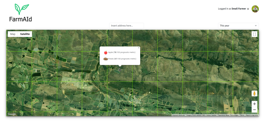
FarmAId steps in as a helpful friend to farmers. By using satellite data, FarmAId provides personalized advice powered by AI. It understands the unique characteristics of the land and recommends crops that will thrive there. It also takes changing weather patterns into account, suggesting resilient crops that can withstand climate challenges. More than just recommendations, FarmAId acts as a knowledgeable companion, offering insights and expertise. It helps farmers make better choices, ensuring their hard work pays off with good harvests and improved income. Ultimately, FarmAId aims to make farming not just sustainable but also profitable, securing both the farmers' future and our food sources.
EU space technologies
For our platform, we took into account two features: soil analysis and climate forecast. We have done soil texture analysis based on the Normalized Difference Moisture Index (NDMI) and the Red-Edge Normalized Difference Vegetation Index (ReNDVI), where we used Near Infrared band (NIR), Shortwave Infrared band 1 (SWIR1), and Red-Edge band from Sentinel-2 observations. We classified the soil texture by the threshold values. For the climate forecasts, predictions of Copernicus Climate Change Service is used. Also worth to mention that, during the hackathon, we found that our model can give the best outcomes if we use ground data together with the space data.
Space for International Development & Humanitarian Aid
At Farm Aid, we believe that small farmers are the backbone of our food system and the guardians of our environment. We offer our users AI solutions to know their fields better, grow clean food that supports biodiversity, do long-term planning to reduce financial risks and get subsidies for particular crops. Our mission is to empower small farmers with the knowledge and resources they need to thrive in a changing world. We aim to create a more sustainable, resilient and fair food system for everyone.
Team
Abdullah Bazarov: Applied Physicist with experience in machine learning algorithms, completed projects by using Copernicus and GNSS data, grew up in farmer family.
Liina Freivald: 25 years of experience in project, product management in the IT industry. Entrepreneur and innovator in the service of sustainability.
Andriy Tymchenko: seasoned IT professional with entrepreneur skills; long-term focus on B2B segment, remote sensing and earth observation for agricultural topics.
Karl Matti: Full-stack developer with years of experience, coding enthusiast .
Jaan Mürk: Software engineer with experience from financial sector, transport and manufacturing industry.
Chigozie Nkwocha: A biochemist, with an interest in data science and its applications in biological science and health.