ChangeTrace
Utilizing open remote sensing data and modern technologies to foster safe spatial development and maitenance.
- 4,807 Raised
- 1,078 Views
- 1 Judges
Team
Tags
Categories
Gallery


Description
Idea
News stories, both recent and already archived, show a sustained pattern in infrastructure and building development wherein construction work is conducted without the necessary permits or regulatory checks. This includes all scales of construction - from large infrastructure projects such as of a windpark that would hinder the functionality of national defence systems by Aidu Tuulepark OÜ in Estonia in 2018 (ERR, 2018) to residential buildings such as “Dižozolu nami” in Riga in 2022, where a protected tree was cut to give way for housing (LSM, 2022).
These examples already demonstrate that noncompliance with building regulation and lack of early regulatory checks can create security hazards as well as destroy valuable natural heritage. There is a wide variety of case and effect examples both reported in the news and going under the radar - with spatial development being a crucial component of economic development via creation of functional infrastructure and spaces, this can affect the well-being of communities on a large scale.
The detection of such illicit construction work often relies on citizen vigilance, meanwhile the inspection of reported sites alongside routine inspections overwhelm building authorities, who have no concrete way to prioritise inspections and work under constraints of public resources.
This hints to the need for new tools for local building authorities and national regulatory bodies to identify areas of potential illicit construction work and to appropriately prioritise the inspections in these areas. With ChangeTrace we want to address this need by leveraging the optical and SAR satellite data provided by the ESA to create an early warning system for flagging potential cases of illicit construction work.
EU space technologies
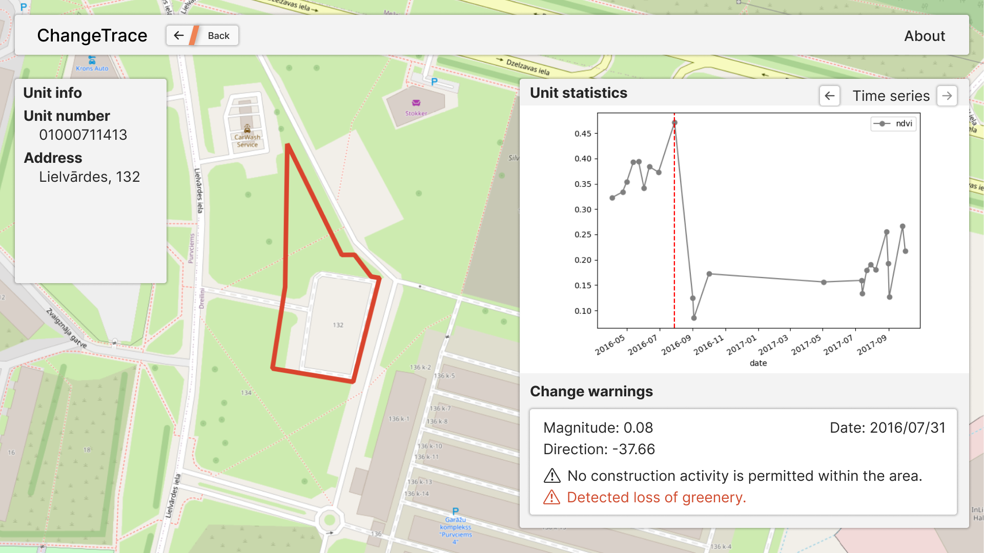
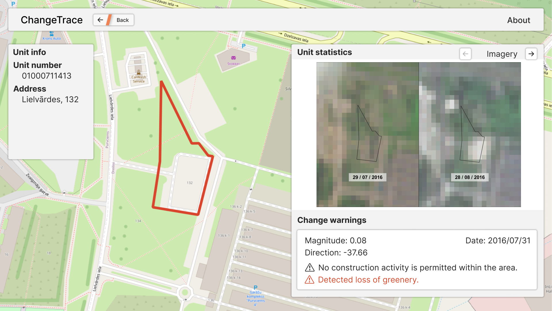
Our methodology is based on various optical indices (e.g. NDVI, NDBI) derived from Copernicus Sentinel-2 L2A data acquired from "Dataspace"
Space for International Development & Humanitarian Aid
The project is being developed under "Supporting sustainable infrastructure development" challenge using Riga, Latvia, as a case scenario. The monitoring of construction, however, can be applicable for various countries, both developed and developing, while the time series analysis method is widely applicable for other problems, for example, detection and monitoring of forest clear cuts.
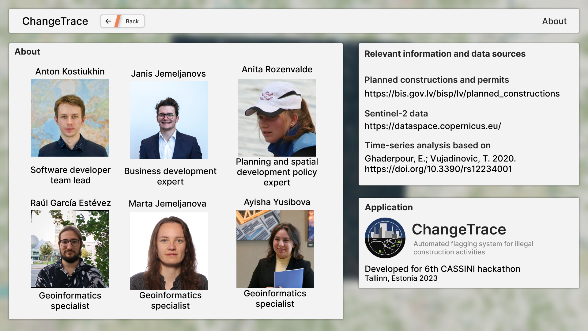
Team
Our team consists of people with different backgrounds to accommodate project needs:
Anton Kostiukhin is the software developer in the team, with experience in designing and implementing solutions for remote sensing applications.
Anita Rozenvalde is a planning and spatial development policy expert, with experience in developing new approaches and tools for sustainable governance that utilise existing spatial datasets and existing data infrastructures.
Marta Jemeljanova is a PhD student in Geoinformatics (University of Tartu). Marta has background in environmental science and currently researching spatial machine learning.
Janis Jemeljanovs is our business development expert, with background in Marketing, Sales and Business Administration.
Raúl García Estévez is a geographer with specialisation in Geospatial data management and applied Geoinformatics for human geography.
Ayisha Yusibova is a geoinformatics specialist, experienced in GIS-related data analysis for environmental studies.