Homing Pigeon Drones
Offering a resilient and secure means of rescuing pilots or specialized forces in distress.
- 0 Raised
- 1,258 Views
- 0 Judges
Tags
Categories
Gallery

Description
Summary
The Homing Pigeon Drones are designed to provide a solution for rescuing pilots or specialized forces in distress, particularly when they are stranded in enemy territory or other high-risk environments. The primary goal of the system is to ensure that, in the event of a crash, the pilot can securely transmit their location back to the base while being exposed to jamming, enemy detection, or interception. This system uses advanced autonomous navigation, resilient communication technologies, and integrated sensor systems to ensure safe return and rescue operations.
Core Challenges
In hostile areas where communication can be easily disrupted by jamming, traditional methods of transmitting distress signals, such as relying solely on Galileo or radio signals, are vulnerable to interference. Pilots in distress may lose contact with their command centers, and their location might become untraceable by conventional means. The challenge is to create a drone system that can:
Navigate autonomously, without Galileo, using preloaded maps and terrain features.
Bring encrypted location information and messages securely, without being exposed to jamming or interception.
Solution Overview
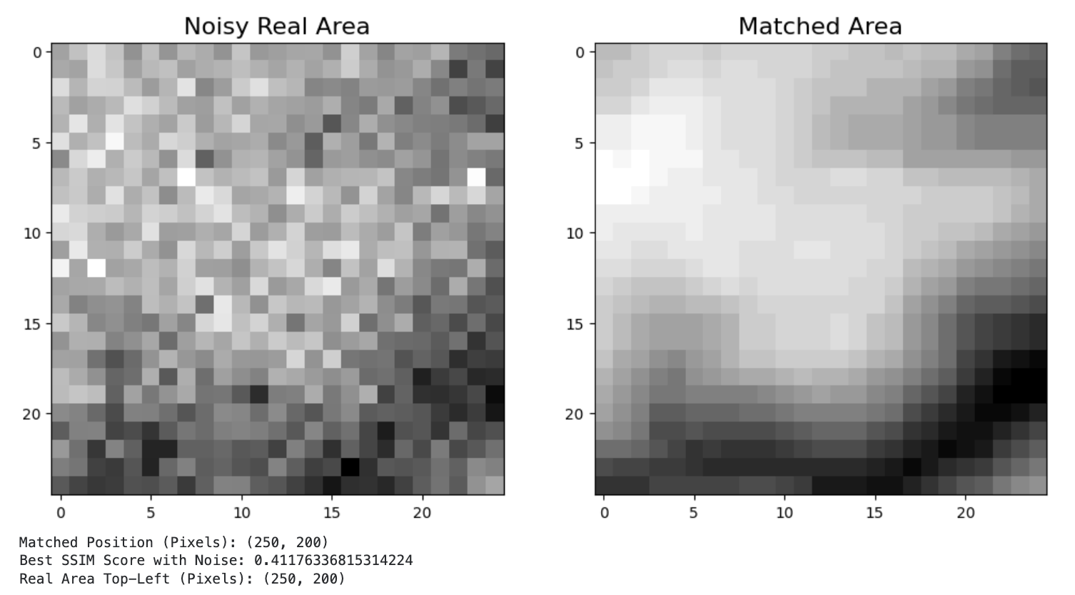
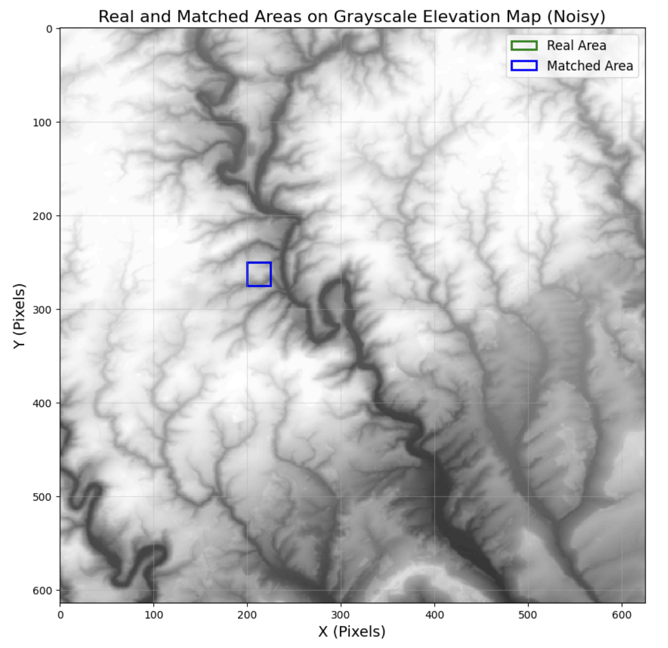
The Homing Pigeon Drones represent a modern adaptation of homing pigeons. This innovative system provides a solution for pilots or special forces in distress by utilizing a combination of preloaded map data and advanced sensors. In the event of a crash, the pilot can activate the drone, which autonomously returns to base by using an integrated Copernicus digital surface model and terrain contour matching.
The drone targets predefined beacons that can be located on the preloaded map, allowing it to transport the pilot’s location, key messages, and other crucial information securely.
Minimal Viable Product:
Small UAV frame, with electric motors and lithium battery
Flight Controller with extended storage and dedicated firmware
RGB Camera
LiDAR surface elevation
IMU with Compass
Beacon signal receptor in the safe zone (using Galileo)
Copernicus digital surface model Software: terrain contour matching
Data encryption of the message
Secured box for the drone’s onboard computer
Future work and pending challenges:
Although our solution is proposing an operational system, there is room for some improvements:
Product extension:
Better accuracy by including other instruments and technologies such as computer vision using AI and multispectral imaging
Path optimization using better algorithms
Hardware resources capacities upgrade, while considering the eventual power consumption and the weight impact
Drones deployment for injured pilot
Enemy recognition:
Auto-destruction implementation in case the drone is captured
Stealthiness enhancement by adapting the shape and the materials
Cybersecurity especially for unique signature of the drones and data encryption
Team extension:
Aeronautics specialist
Legal/compliance officer
Mechanical engineer
Extension of Applications
Defense: Informations sharing
Friendly -> hostile
Hostile -> friendly
Rescue during Natural Disaster area
Remote area: Crash in remote area
Libraries used
numpy
matplotlib
scipy
pillow
scikit-image