FirePoint
Solution for fire detection, fire prediction and fire prevention with the help of geospatial data.
- 0 Raised
- 404 Views
- 0 Judges
Tags
Categories
Gallery

Description
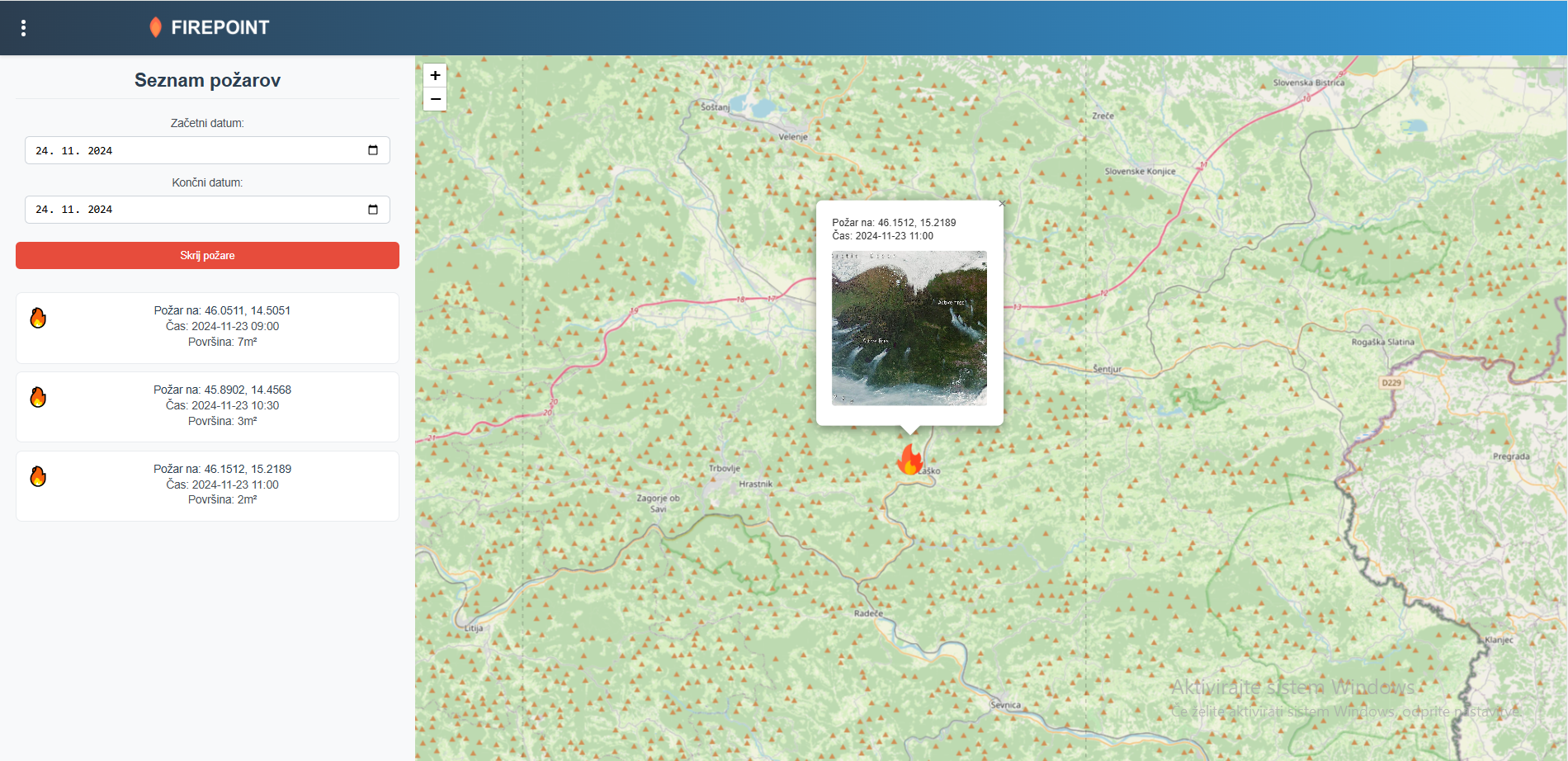
FirePoint leverages Copernicus Earth observation data and Galileo satellite positioning signals to create real-time risk maps, fire alerts, and predictive models. This system identifies high-risk areas, provides data-driven recommendations for safe construction zones, and supports emergency planning. Using satellite thermal imagery, environmental monitoring, and precise geolocation, FirePoint empowers civil protection agencies, builders, and insurers to mitigate risks, protect lives, and ensure sustainable development.
Value of EU Space Technologies:
- Copernicus provides critical thermal and vegetation data for detecting wildfire-prone areas and monitoring environmental conditions.
- Galileo ensures precise geolocation for mapping evacuation routes, analyzing infrastructure placement, and ensuring accurate fire response coordination.
These technologies enhance FirePoint's ability to offer actionable insights, improve safety, and optimize resource allocation for disaster management.
Team Overview:
- Damir Šarlah: Idea cerator and the heart of the team.
- Žan Povše: Software engineer focusing on backend and AI.
- Benjamin Petelinek: Lead for user interface design and platform usability.
- Gal Leitgeb: Specialist in satellite data processing and data acquisition.
Attachments
Copyright © 2026 All rights reserved. Powered by LayerX