Circum: Copernicus X data collected locally to evaluate circulability
We use a blockchain infrastructure to collect all kinds of geospatial data from untrusted but numerous local source. It complete Copernicus datasets and can be used for military op or emergency aid.
- 99 Raised
- 507 Views
- 1 Judges
Tags
Categories
Gallery

Description
GitHub:
- https://github.com/IDLhackathon/market
- https://github.com/IDLhackathon/circum-web3
- https://github.com/IDLhackathon/shortest_path
Problem:
The military, emergency response teams and humanitarian aid forces often lacks good understanding of their operating grounds. Maps may be imprecise and ancient. Off-roads mobility is often crucial in these operations but isn't always expected by maps providers.
Satellite data plays a really important part is these contexts but can't be exhaustive. The thickness of the mud or the cover of the trees challenge satellite capabilities.
Team:
The core of our team is composed of the co-founders of the company Extra: Bertrand, Charlie and Laurent are building the Circum Protocol, a decentralized infrastructure meant to provide geospatial datasets by relying on local sources. These sources are untrusted and mainly anonymous, but the protocol use economic incentive and a consensus based on reputation to determine the most truthful version of the data. (See Reference)
Circum is a very early project and didn't have any published code before the hackathon. Florian and Dhruv joined our team to reinforce our deep learning and blockchain capacities.
Charlie Durand: Product & Business profil, 4y xp as an entrepreneur, sold services to Renault, Radio France and a bunch of french collectivities;
Dhruv Malik: 3y xp as cybersecurity and blockchain engineer;
Laurent Caraffa: 10y xp in 3D surface reconstruction algorithms, computer vision, deep learning and big data. Researcher of the IGN (French Geographic and Forestry Information Agency);
Bertrand Juglas: 20y xp as a infrastructure and blockchain engineer, GoodDollar and SuperFluid Ambassador;
Florian Labaye: Student of Ecole Polytechnique in computer science;
Solution:
We complete the Copernicus data with data provided by local population and both sources are processed by deep learning to determine an ideal path.
What: Datasets collected locally can be point clouds from LiDAR sensors, video or photo using smartphone. They are confronted with Copernicus or Sentinel images.
Who: Depending on the context, local data providers could be citizens, dissidents, soldiers, companies, associations or publics institutions. The point of the system is that everyone can submit data to improve the terrain knowledge. Anonymity of the provider is protected.
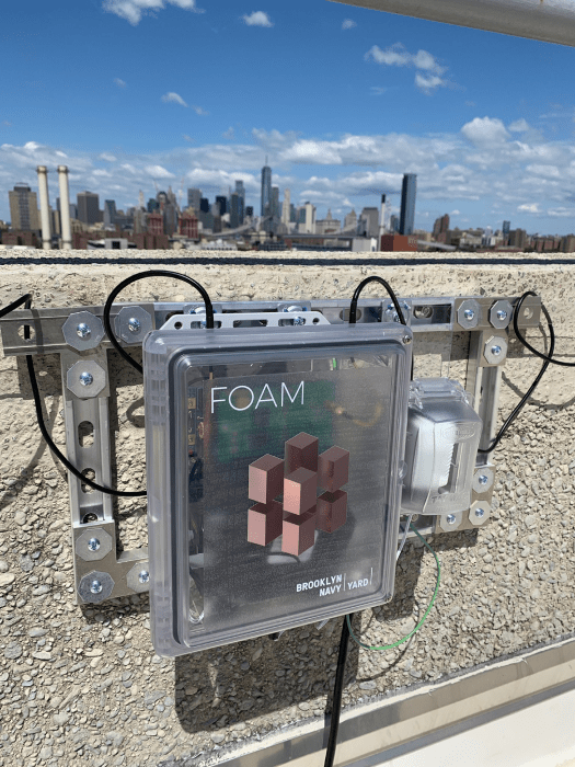
Where: The ability to localize (and time-stamp) precisely data collected locally is crucial. Galileo's PRS or ONSMA services are compatible with this mission as well as FOAM's Proof-of-Location. FOAM uses short-range, backpack-sized radar beacons to create a ground-based alternative to GNSS.
When: Our solution can be deployed before the operations, to build and maintain a digital twin of the environment, or during the intervention for more straight-forward needs.
How: Our system uses blockchain to pay data providers for their data. It create incentives for people and also for companies to organize in order to provide data. A Proof-of-Stake system ensure that providing false data is ultimately expensive for the corrupt provider. We then use detection and classification algorithms to extract information from datasets, computational geometry to position data and graph theory to determine the shortest path (See References).
Why: Blockchain provides traceability of the information, scalability thanks to computing decentralization, relative anonymity and a cross-border value system. Moreover, it lowers the price of the data by several orders of magnitude by eliminating intermediaries and blocking margins.
Demonstration (See Video):
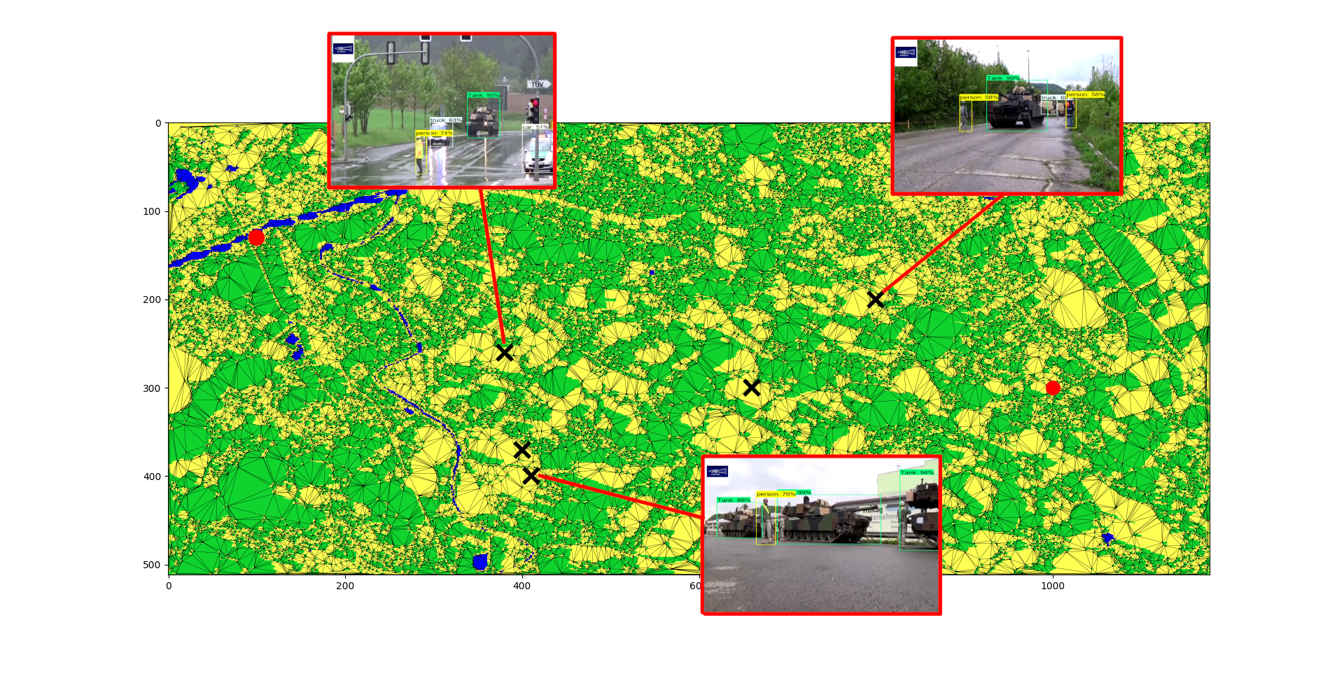
For the demonstration we focus on the Ukrainian war case. Here, data used are pictures of roads and open fields submitted by citizen. Pictures are time-stamped and positioned using Galileo through Starlink's services or using FOAM.
We showcase a Copernicus image from eastern Ukraine. Classification algorithms identify open fields, roads and forest. We then compute the shortest path using graph theory a first time. We add the result of the blockchain-powered crowd sourcing on top of the map, showing new obstacles and information. We compute the shortest path a second time.
We then move on to the back-end, the side of the blockchain. We show the citizen identified by his address loading some data. This one is bought by the client, the transaction is displayed.
Business Model:
We sell strategic data access, processing and simulation tools to business and institutions. Potential customers are the military, NGOs, researchers... Data are thoroughly encrypted.
Beside this cross-terrain mobility use case, the whole digital twin market is accessible to our protocol. By collecting and merging 3D geospatial data, we could provide valuable services to the construction, smart cities, gaming or autonomous air and land mobility industries.
Resources used:
- Datasets - Pictures of military equipment in Ukraine (Oryx)
- Datasets - Pictures of military equipment in Ukraine (Kaggle)
- AI data marketplace - Used to build a POC of our crowd-sourcing infrastructure (Ocean Protocol)
- Spicy Spatial Delaunay
- NetworkX - Shortest path algorithm
References about the use case:
- How the geospatial community mapped Nepal in 48h after the 2015's earthquake
- The consequences of Mud season in the Ukrainian war