
H2Ai
Description to be written soon
- 0 Raised
- 580 Views
- 0 Judges
Tags
Categories
Gallery
Description
💎 Idea
We are building an early-warning system for upstream water pollution.
Companies that depend on clean water, such as food and beverage producers, bottled-water companies, aquaculture farms, and industrial water users, often discover pollution too late. Manual sampling is slow, local, and cannot continuously monitor long upstream river networks.
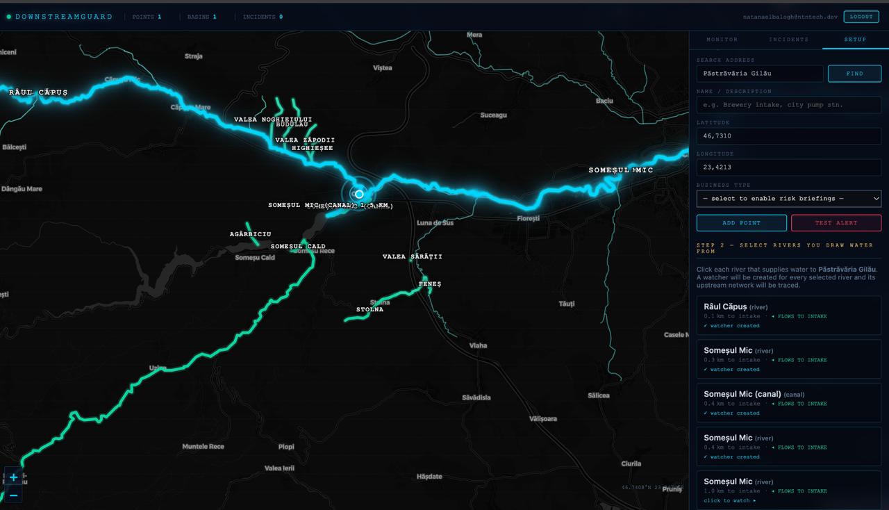
Our solution lets a company select the water area or intake they want to protect. The platform automatically identifies the upstream river network, monitors it using satellite data, detects visible pollution indicators such as turbidity, sediment runoff, mining/tailings runoff, flood contamination risk, and algae-related changes, then sends alerts with the pollution location, satellite evidence, severity, and estimated time of arrival.
In simple terms: a weather forecast for downstream water pollution.
🛰️ EU space technologies
We use European space data and services to monitor water from above.
The core technology is Copernicus Sentinel satellite data, especially:
Sentinel-2 for optical water-quality signals such as turbidity, suspended sediment, water color changes, and algae-related indicators.
Sentinel-1 for radar-based flood detection, useful when clouds block optical imagery and when floodwater may mobilize pollution from industrial, agricultural, or mining areas.
Sentinel-3 for larger water bodies, reservoirs, lakes, and chlorophyll/algal bloom monitoring.
We intend to process these data through openEO and Copernicus-compatible data services. The system converts satellite observations into business-ready alerts by combining satellite imagery, AI anomaly detection, upstream river mapping, and estimated downstream travel time.
This brings value because companies do not need to understand raw satellite data. They receive a simple answer: where the risk is, what was detected, how serious it is, and when it may reach them.
🌐 EU Space for Water
We contribute to protecting and managing water resources by focusing on water quality monitoring and pollution risk management.
Our solution helps detect upstream water-quality threats before they affect downstream users. It supports better water management by giving companies and authorities earlier visibility into pollution events, especially in rivers where manual monitoring is limited.
The platform contributes to:
Protecting water quality through satellite-based detection of turbidity, sediment, runoff, and bloom-related risks.
Improving preparedness by estimating when pollution may arrive downstream.
Reducing environmental and economic impact by helping companies react earlier, increase sampling, adjust operations, or notify authorities.
Supporting evidence-based decisions by providing satellite images, maps, and audit-ready alert reports.