LifeLine Sentinel
LifeLine Sentinel is a smart AI-driven system using satellite and GNSS tracking to monitor extreme sports athletes’ vitals in real time, alerting to health risks and optimizing performance.
- 0 Raised
- 571 Views
- 0 Judges
Team
Tags
Categories
Gallery


Description
LIFELINE SENTINEL - AI SAFETY AND PERFORMANCE COACH FOR EXTREME SPORTS ATHLETES
Executive summary
LifeLine Sentinel is an AI-driven extreme sports athlete safety and performance system that fuses wearable vitals, smartphone/edge analytics, Galileo/EGNOS GNSS positioning, and satellite fallback messaging. It provides early warnings for heat stress, dehydration, overexertion, and falls, off-grid and in real time, while giving crews and race organizers a live map with risk scores and recommended actions. Galileo/EGNOS deliver precise, integrity-enhanced positioning; Copernicus datasets (DEM, atmosphere/temperature) enrich environmental context for risk estimation.
Problem (beta)
Ultramarathons (50-300+ km) increasingly traverse remote terrain with poor cellular coverage, high heat exposure, altitude gain, and sleep deprivation. Crews and organizers lack continuous vitals and position telemetry, delaying interventions; extreme sports athletes often miss subtle physiological warning signs until it’s too late. Existing wearables rarely provide personalized risk assessments or function reliably beyond cellular networks.
Target users and value
Extreme sports athletes: real-time, personalized coaching (cooling, hydration, pacing) and automatic fall/SOS detection.
Crews: live Risk Score (0-100), location, last alert, and specific recommended actions.
Organizers/medics: course-wide situational awareness, faster triage, incident heat map, audit trail.
Insurers/venues: documented risk mitigation and improved event safety posture.
Objectives and success metrics
Safety: detect risky states (heat stress/overexertion/fall) with <45 s time-to-alert in demo conditions.
Reliability: operate with satellite fallback when cell is unavailable; 60-120 s burst cadence.
Accuracy: GNSS track error ~1-2 m in open terrain with dual-frequency receivers where available; integrity flags for crews (EGNOS region).
Usability: one-tap start; clear green/amber/red states; actionable, short recommendations.
Privacy-by-design: on-device processing by default; minimal data sent (risk + last fix).
System overview
Extreme sports athlete kit (BLE sensors + smartphone) computes a real-time Risk Score from HR/HRV, skin temp, SpO₂, motion, and terrain/ambient context. A GNSS module prioritizes Galileo signals and leverages EGNOS integrity in Europe. Primary backhaul is cellular; when unavailable, a satellite short-burst payload (compressed JSON) is sent at a set cadence. A crew/organizer dashboard displays live tracks, risk states, and guidance; alerts trigger notifications.
Space components
Galileo + EGNOS: high-quality positioning plus integrity message for reliability in Europe.
Copernicus data: DEM (COP-DEM GLO-30) for grade/elevation context; atmosphere/temperature products for environmental overlays during planning and post-race analysis.
Satellite IoT (e.g., Iridium SBD) for off-grid alerting when cellular is unavailable.
Components and architecture
Mobile (Extreme Sports Athlete) app
Inputs: BLE chest HR/HRV, skin/ambient temp, SpO₂; phone IMU and barometer; GNSS raw or Fused Location.
Edge AI: computes per-athlete baseline, detects anomalies, and fuses risks into a single Risk Score.
GNSS: uses dual-frequency (E1/E5) when the handset supports it; on Android 10+ raw GNSS is widely available for advanced processing.
Comms: HTTPS/WebSocket (cellular). Satellite mode sends compressed bursts (60-120 s) with last fix, risk, and reason codes.
UX: large color states (Green/Amber/Red), hydration/cooling tips, manual SOS, and 'satellite mode' toggle.
Backend (lightweight)
Ingest API: receives updates; authenticates extreme sports athletes; stores rolling 60-120 min window.
Processing: validates EGNOS integrity flag where available; enriches with DEM/elevation and route GPX.
Events: pushes alerts to crews/organizers via WebSocket; maintains a minimal audit log.
Crew/Organizer dashboard (Web)
Map: live extreme sports athlete positions with accuracy/age badges, elevation profile, recent risk timeline.
Alerts: prioritized queue (extreme sports athlete, level, reason, recommended action).
Overlays: course profile (DEM), heat/temperature layer for context (preloaded tiles for demo).
Admin: team management; opt-in data sharing; export incident report.
Data and models
Signals and features (30 s windows)
Cardio: HR, HRV (rMSSD), HR drift vs pace/grade.
Thermal: skin temp and trend; optionally ambient T.
Motion: cadence variance, vertical oscillation, fall G-spike; no-movement detector.
Terrain: grade from DEM; elevation gain rate; altitude.
Risk classes and fusion
Heat stress: rising skin temp + HRV drop + HR/effort decoupling, modulated by ambient temperature layer (if available).
Overexertion: sustained HR above baseline zone with HRV suppression and high gain rate.
Fall/SOS: IMU spike, speed collapse, no-movement ≥30 s; manual SOS override.
Fusion: logistic scores per class → weighted sum → Risk Score (0-100) with hysteresis for stability.
Personalization
Baseline adapter: rolling median and variance per extreme sports athlete/session; acclimatization factor over time.
Calibration: 15-60 s warm-up to establish initial baselines; optional profile import from past runs.
Positioning and integrity (space)
Galileo + EGNOS: We prioritize Galileo signals and apply EGNOS in Europe for higher accuracy and an integrity message (confidence on residual errors), which is crucial when triggering medical alerts.
Dual-frequency readiness: modern Android devices support raw GNSS measurements, enabling improved accuracy and signal quality checks when available.
High-accuracy path: future upgrade can ingest Galileo HAS PPP corrections for decimeter-level positioning where suitable hardware/software are available.
Environmental context (space)
Terrain context: Copernicus DEM (GLO-30) gives grade/elevation for effort-normalized pacing and risk estimates (e.g., climbs with heat).
Atmosphere/temperature: CAMS/C3S products provide authoritative data for heat-risk analysis and planning (e.g., pre-race heat maps, post-race analytics).
Satellite fallback (space)
When cellular is absent, the app enters satellite burst mode: compact, binary-encoded JSON (extreme sports athlete ID, timestamp, last GNSS fix, risk level, reason, and optional SOS) is sent via SBD-class services; crews receive periodic updates with low battery and bandwidth overhead.
Security, privacy, and ethics
On-device by default: risk inference local to phone; cloud stores only short-term streams.
Minimal data: position + risk + last 60-120 min unless extreme sports athletes opts in for analytics.
Consent and control: per-athlete consent; explicit sharing with crew/organizers; manual SOS.
Compliance: not a medical device; presents advisory guidance, not diagnosis.
Safety UX: conservative thresholds + hysteresis to limit false positives; clear human-override.
Implementation plan
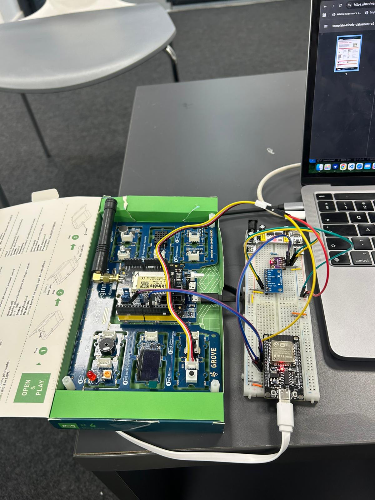
Hackathon MVP (what we will demo)
Extreme sports athlete app: BLE simulator for HR/HRV/temp/SpO₂; GNSS track; Risk Score banner; satellite mode toggle.
Dashboard: live map, per-athlete Risk Score timeline, alert panel, and action tips.
Scenarios: (A) heat stress ramp → Amber→Red alert; (B) fall + no-movement → SOS and last fix.
KPIs demoed: time-to-alert, alert stability, connectivity failover.
Post-hackathon milestones (90 days)
Field pilots with two trail clubs; collect de-identified telemetry for model tuning.
Hardware integrations (popular chest straps; optional temp patch).
EGNOS integrity display and handset validation; investigate HAS/PPP path.
Partner data (race routes, aid-station locations) for situational overlays.
Risk model v2 with semi-supervised personalization and WBGT proxy input.
Validation and testing
Bench tests: simulator sweeps for HR/HRV/temp, terrain and cadence; ROC/PR metrics per class.
Outdoor dry-runs: controlled heat/effort protocols; compare alerts vs. predefined triggers.
Positioning: log GNSS quality; compare EGNOS-region integrity flags and track error on open trails.
Usability: crews perform timed response drills based on alerts and recommendations.
Risks and mitigations
Sensor variability: support multiple BLE devices; smooth via robust baselines; confidence flags.
GNSS multipath/forest canyons: dual-frequency support; trail map-matching; integrity indicators.
Connectivity costs: satellite used only in exception mode with compressed bursts.
False alarms: multi-signal fusion + hysteresis; require persistence >N seconds; human acknowledge.
Regulatory perceptions: clear non-medical labeling; conservative guidance; expert medical review panel.
Business and partnerships
Model: B2B2C with organizers (per-athlete event fee) + crew/team packs; optional device rental.
Partners: race organizers, insurer risk teams, satellite service providers, GNSS handset OEMs, sports medicine advisors.
Moats: safety-grade UX, off-grid reliability, privacy-first design, and space-augmented context (EGNOS integrity + Copernicus overlays).
Roadmap highlights
Coach Mode (training): adaptive sessions using terrain/heat context.
Group Safety: expedition/team view with geofenced alerts.
High-accuracy positioning: selective Galileo HAS adoption with compatible receivers for critical events.