R-DIRECTION
Real time updating map of the Arctic. To guide ships in the right-direction.
- 6,280 Raised
- 256 Views
- 1 Judges
Tags
Categories
Gallery
Description
💎 General Idea
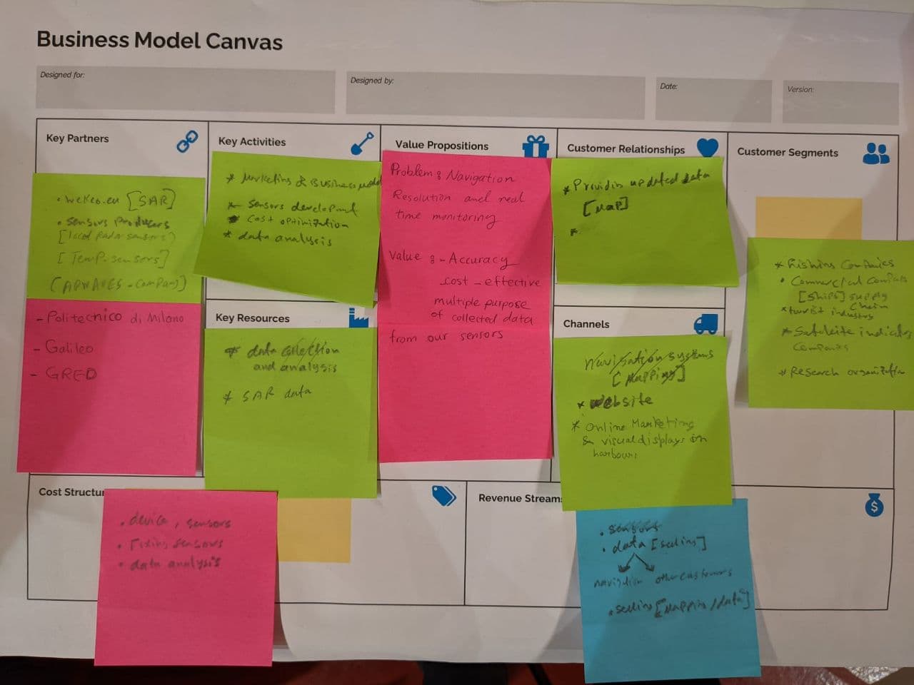
Our idea is to make ship routing more accurate. We want to do this by implementing a denser GNSS observation network to support ionospheric monitoring network developments.
🚀 Solution and EU space technologies
We intend to use the Galileo global navigation satellite system to detect suitable spots for installing our sensors. The next step is to install several sensors on the detected spots. They will be connected to already existing stations on the coastal areas in Sweden, Greenland, Russia, and Canada to complete the network. The data will be gathered and analyzed on our property platform. It will be also matched with the Copernicus SAR data to enhance the accuracy. The outcome will be an easy-to-use interface for fishermen and an on-demand report for research organizations.
That was how we are planned to use EU space technologies such as Galileo GNSS and Copernicus SAR data to build our final business.
❄️ Connecting the Arctic
Our team is focusing on solving the first challenge, which is called safe passage at sea. One fundamental topic on this is to optimize routing navigation. We found this topic interesting because this is an unsolved challenging problem for Arctic ships and fishermen. Also, we think our background can lead to more novel and accurate solutions besides its business value.
Team
- CEO, Razieh Ahmadi: A Telecommunication Engineering master's student at Polimi and also an R&D expert
- COO, Avijit Bhattacharya: A Polimi Electrical Engineering MSc student with site electrical engineering experience
- CTO, Erfan Alimohammadi: Data scientist and software engineer, pursuing an MSc degree at Polimi
- CMO, Ahmed Ali: A Management Engineering master's student at Politecnico di Milano